


The Gifford Pinchot Wilderness has been on my bucket list of places to ride forever. This massive area that encompasses over 1.3 million acres and spans between Mount Saint Helens and Mount Adams in southwestern Washington state offers countless options for gravel riding on forest service roads, dispersed backcountry camping, and exploring through caves, lava tubes, huckleberry fields, and rivers.
As my summer plans started to come together, I reached out to my friend Eliot who’s been a reliable bikepacking buddy for a few trips to see if he was interested in joining. I love planning trips with Eliot because he’s really good at it. He’s literally an Eagle Scout, and embodies so many characteristics I admire (and wish I had): super knowledgable in the outdoors, always prepared, and organized. His job was to plan the route, while I’d take care of food.
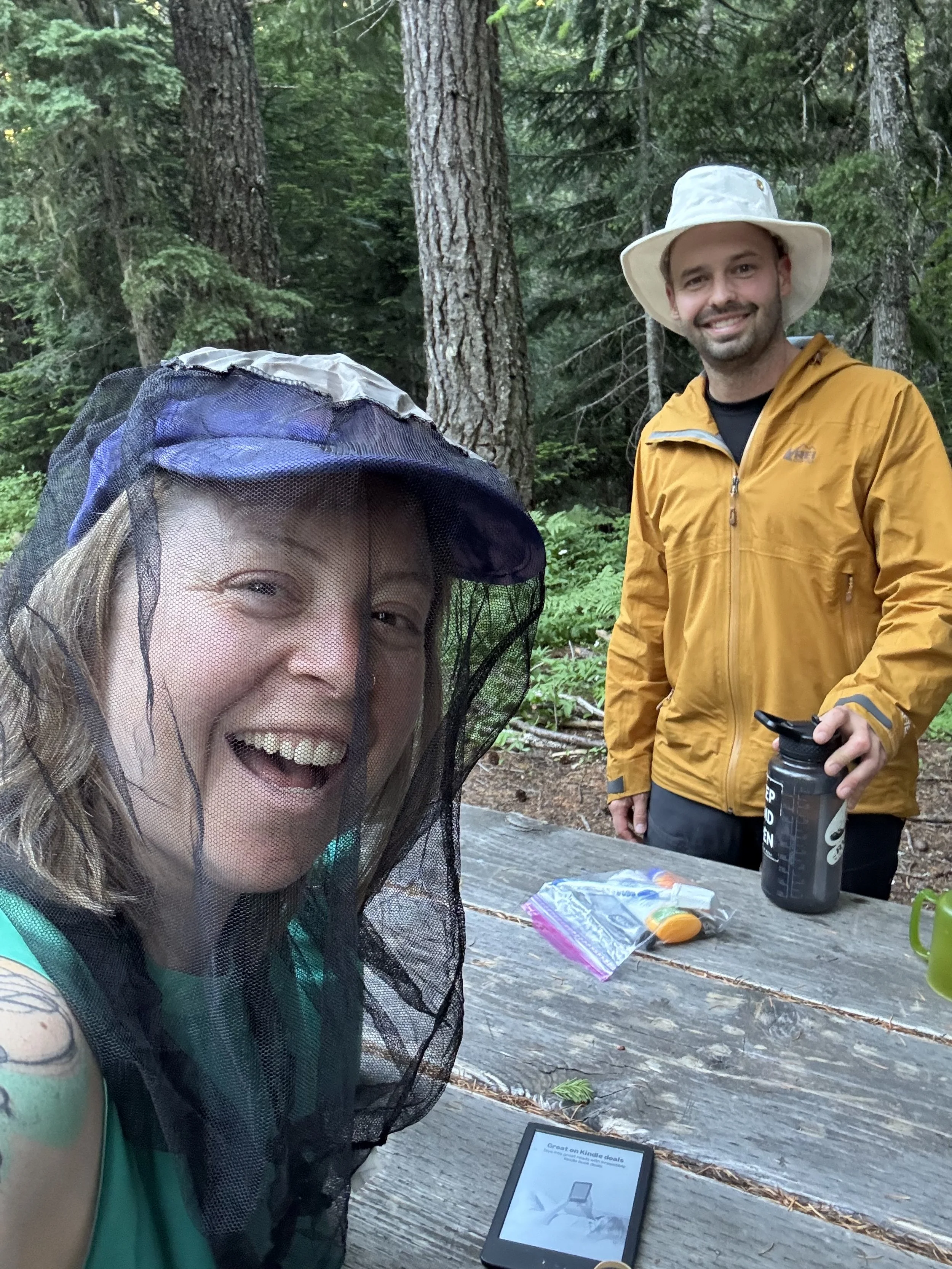
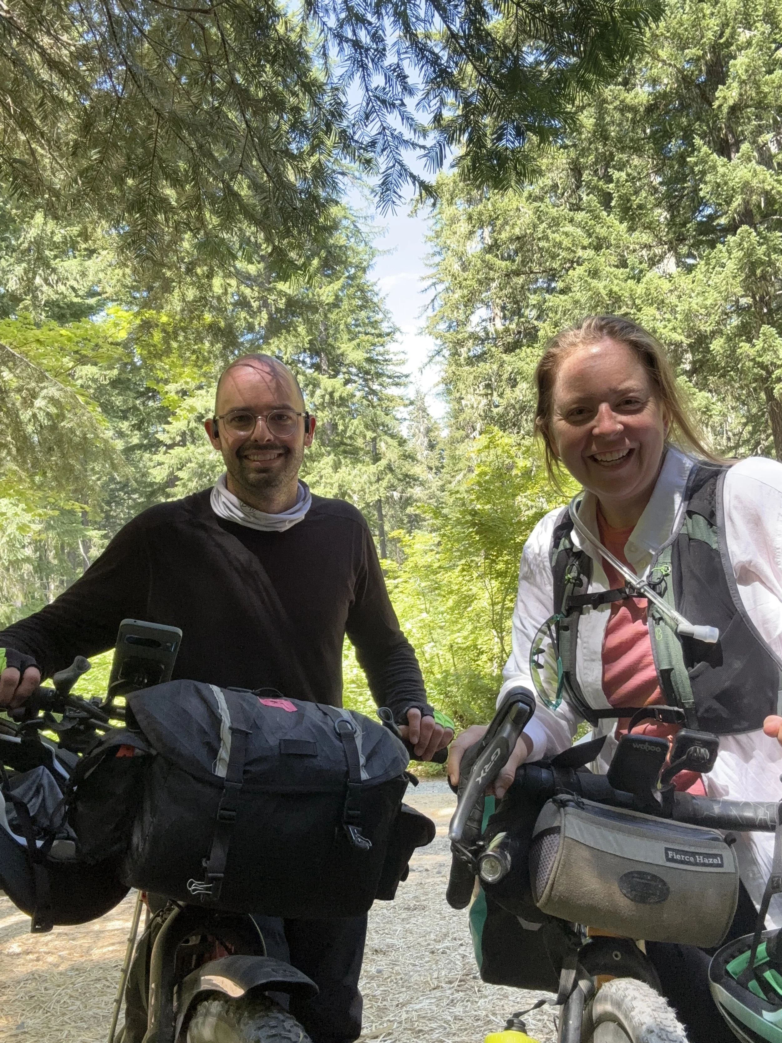
Hanging at camp with Eliot
We built our trip with a few goals in mind:
Get out into the woods
Spend 3 days riding, and 2 nights camping
Have fun and stay alive
With these in mind, Eliot put together an incredible route that was built by combining two previously existing routes, The Fire and Ice Cave Loop from Bikepacking.com, and a route from Our Mother The Mountain. Clocking in at 91 miles with nearly 8,000 feet of climbing, this was definitely my most ambitious bikepacking trip, but turned out to be the most rewarding in terms of views, company, and fun.

My Bike Set Up
I rode my do-it-all Cannondale Topstone 4, equipped with a back rack and panniers. I was definitely underbiked for the single-track portion of Day 2, but was otherwise quite happy with my choice of ride. The route is a nice combination of gravel roads, beautiful pavement, and single track, but nothing was ever too technical.
This is the same bike I recently rode both Unbound Gravel 100 and The Oregon Gran Fondo, proving it’s a truly capable bike. It’s currently got the Shimano mechanical 2x12 GRX Groupset on there, with GRX brakes and wheels, and it performed beautifully. There were a few times where I could have used some additional climbing gears, but I’m not too proud to push my bike up a hill when it gets too steep.
For this trip, I ran 700x42 IRC Boken Double Cross tires, set up tubules at 40 psi (both front and rear.) No notes on tires, although Eliot ran 2.2” tires and also seemed to be quite happy, especially on the single track.
My biggest challenge with this bicycle is the size of it. It’s tiny, which doesn’t provide much space for either luggage or water carrying. To solve this, I simply packed in Ortleib panniers and mounted water bottle cages to my front fork. I also carried a hydration pack from Osprey. Fully loaded I was able to carry 2.5 liters of water, which was sufficient with periodic refills from mountainside streams (filtered of course.)
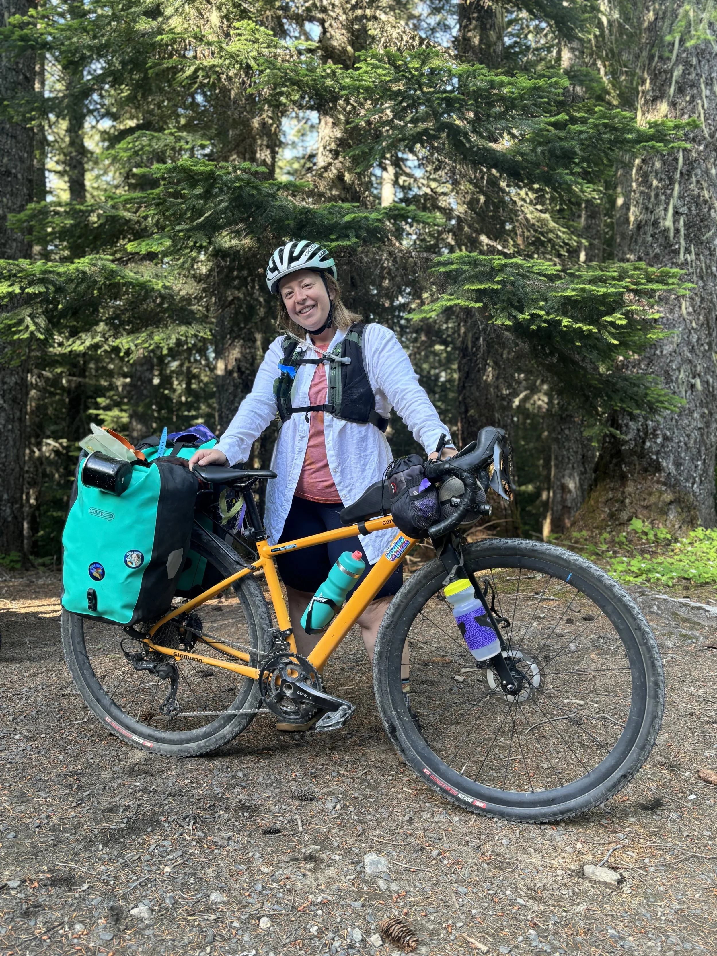
My bike setup
Food, Route Highlights, and More
As mentioned earlier, I was responsible for the food planning portion of the trip. If you know me, you know that I hate even the idea of being hungry, so I majorly overpacked on food. As I was unloading my pannier at camp the first night, Eliot summed it up well: “I packed to survive on this trip. Marley packed to be happy on this trip.” And it’s true - we ate good and were never hungry.
Our meals were:
Breakfasts - Oatmeal with peanut butter, chia seeds & mini chocolate chips, Dried Mango
Lunches - Tortilla wraps with chickpeas, tuna, dried bell pepper, and tortillas with salami & cheese
Dinner - Homemade pasta with veggie sauce & Dehydrated meals
Snacks - Everything including candy, fresh fruit, beef jerky, cookies, and more!

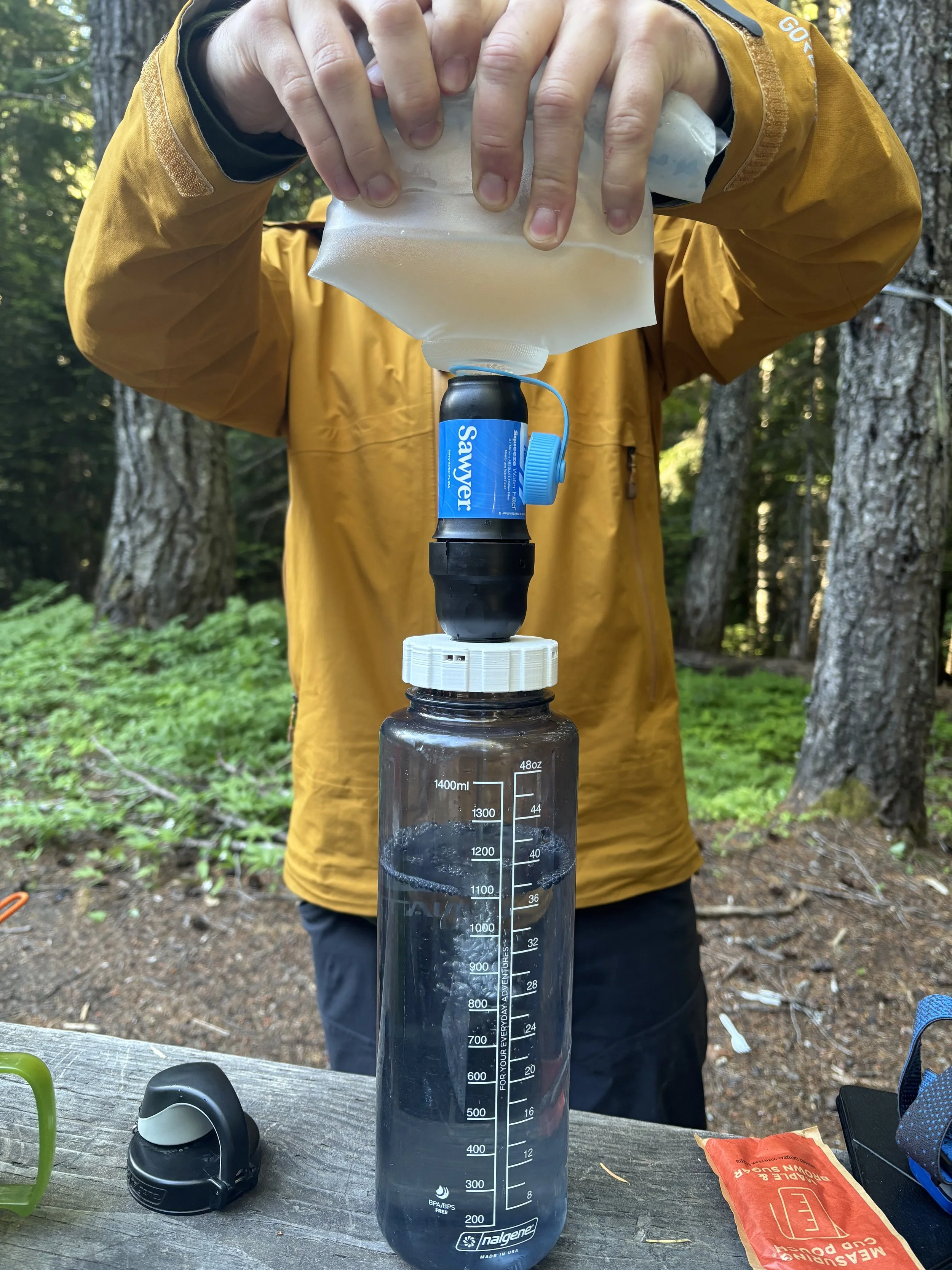
Importantly, we packed and shared a Sawyer squeeze water filter to ensure we had clean safe water to drink for the entire trip. Eliot rode with this at all times, which came in handy during our 11 mile climb on Day 2 where we ran out of water mid-way up the climb and were able to refill from a stream on the side of the road. As you can see in the photo below, Eliot 3-D printed the interface between the Nalgene and the actual filter, which proved to work beautifully. I keep telling him to sell his inventions - but he doesn’t listen to me.
We broke the route up into three days, covering 31, 40, and 20 miles on each day respectively. Day 1 started out with a banger of a climb, gaining nearly 1500 feet of elevation in under 10 miles. Though daunting, we took it slow and made it to the ridge line, which we followed for most of the rest of the day. We were rewarded throughout the day with massive views of Mount Adams interspersed with huge, old growth forests. The route passes through a huge huckleberry field, however, we were up there too early in the season to take advantage of any roadside snacks.
We set up camp for the trip at the Falls Creek Horse Camp, a nice little camp group with a pit toilet, picnic tables, and a stream for water access.
Day 2 was a loop, starting and ending at our campsite, which meant we could ride unloaded! Eliot loaded up his handlebar bag with our lunches and snacks and off we went. The route for Day 2 started with a nearly 20 mile descent, the first 11 of which were on single track. Technically labeled a “blue” for intermediate, the trail was super fun and a bit rowdy in places. Had I of been on a mountain bike, I could’ve ridden the entire thing, as there were no drops over 1 foot and no large obstructions. Because I was on a gravel bike, I did end up walking a couple of sections, however, nothing to complain about.
If you do this route, I highly recommend following the direction we traveled, as otherwise you would have some massive single track climbing, which is definitely not my favorite. After the dirt section, we descended for a few more miles, before starting the long climb back up. I was dreading the final climb all day, which would see us gaining over 2500 feet of elevation in less than 20 miles.

Forever climbing
The climb started out gradual, but we were baking in the hot sun. With temperatures hovering in the mid-90s and most of the climb fully exposed on asphalt, it became a game of seeking out the shade to rest, conserving water, and going at a slow but steady pace. After nearly 4 hours of climbing (with lots of resting in there), we made it back to camp, where Eliot rewarded himself with a dip in the creek, and I took a nap in the hammock.
Day 3 was a 20 mile ride back to the car, with just a few hills. Had it been hotter, we would’ve jumped in Goose Lake, however, we took it as a chance to eat some snacks, chat with some fishermen, and enjoy a few last minutes in the forest.
One of the coolest things about this route was the caves, lava flows, and natural bridges. We took lots of time to explore each one we came across. Even though it was super majestic, photos just don’t do it justice.
Reflections and Closing Thoughts
Throughout the trip, I had a constant narrative going through my head - I am so lucky to get to do this. From having a flexible schedule, to a capable body, to a prepared friend to go with, all the stars aligned for this trip. I owe a massive thank you to Eliot, who really took on the brunt of the planning and routing, water filtering, and carried our tent. I was basically just there for entertainment purposes, and think I did an ok job of it.
I am so excited to get back out to that area and explore further.